Subject: Southern Scotland
Period: 1654 (circa)
Publication: Theatrum Orbis Terrarum sive Atlas Novus
Color: Hand Color
Size:
20 x 16.6 inches
50.8 x 42.2 cm
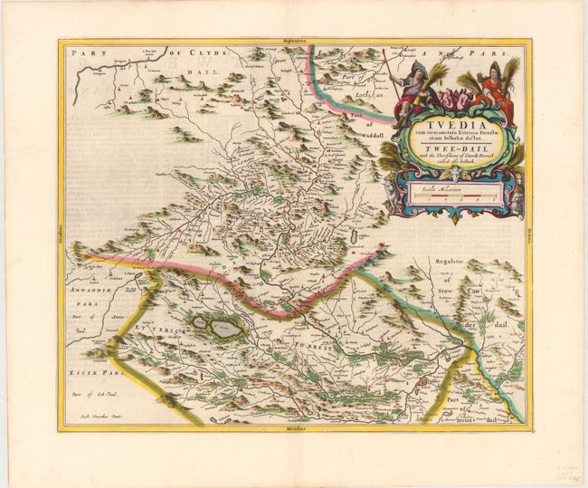
This beautifully engraved map centers on the district of Tweeddale in the Scottish Borders, and includes the surrounding areas of Etrick Forrest, Teviotdale, Lauderdale, Clydesdale and Lothian. The map, based on the work of Timothy Pont, famous surveyor of Scotland in the late sixteenth century, provides great detail of the rivers, cities, villages and castles. Selkirk, the site of the earliest settlements in this area and one of the oldest Royal Burghs in Scotland, appears near the bottom of the map. The map is adorned with a large, elaborate cartouche featuring sheep and two regional figures holding bundles of grain. Latin text on verso.
References: Phillips (Atlases) #5941, v.5 #5.
Condition: B+
A nice impression with attractive color, wide margins, and light show through of text on verso. Two small tears in image have been professionally repaired. A bottom centerfold separation and two short tears in left margin, all far from map image, have been archivally repaired.