Catalog Archive
Auction 142, Lot 356

"Dutch Possessions in South America and the West Indies", Fullarton, Archibald & Co.

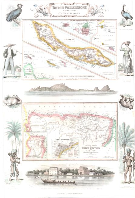
Subject: Northern South America and Caribbean

Period: 1860 (circa)

Publication: The Royal Illustrated Atlas

Color: Hand Color

Size:
12.4 x 17.5 inches
31.5 x 44.5 cm
Download High Resolution Image
(or just click on image to launch the Zoom viewer)

This sheet contains two maps showing Dutch possessions in both the Caribbean and South America. The top map primarily features Saba, St. Martin, and Curacao. The bottom map depicts the Colonised Portion of Dutch Guayana or Surinam with two insets of the Plan of Paramaribo and a Sketch Map Shewing the Extent of the Colony. The maps are surrounded with vignettes of regional figures and animals, as well as views of Curacao and of the cacao plantation in Alkmaar, Suriname.

References:

Condition: B+

A small hole and a short tear at bottom of map of Suriname have been professionally repaired. Margins trimmed on left and right side resulting in minor loss of vignette.

Estimate: $200 - $240

Sold for: $150

Closed on 11/28/2012

Archived