Subject: Barbados
Period: 1810 (dated)
Publication: West India Islands
Color: Hand Color
Size:
18.6 x 23.7 inches
47.2 x 60.2 cm
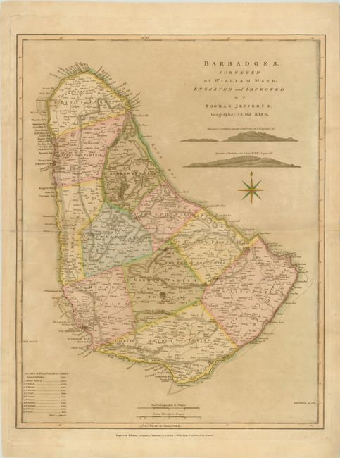
This large-scale map is based on William Mayo's important survey of the island. Mayo's was the second systematic, and first large-scale survey and it fixed the legal bounds of the parishes. It was not until the Admiralty survey of 1873 that Mayo's map ceased to be the standard representation for maps of Barbados. The map shows the eleven parishes with their areas listed in a key below. It depicts the ports, settlements, forts, churches, roads, and sugar plantations with landowners' names. Relief is shown by hachures and two finely drawn landfall approach views for mariners are engraved between the title and compass rose.
References: Campbell (MCC-21) #38.
Condition: B+
Original color with light toning and a faint damp stain that enters several inches into map at left. There is a centerfold separation that enters 4.5" into map at left and an adjacent 1.5" tear that have both been archivally repaired. A large chip in left blank margin has been repaired with old paper, not affecting map.