Subject: Southwestern United States & Mexico
Period: 1858 (published)
Publication: Weekly Dispatch Atlas
Color: Hand Color
Size:
12 x 16.8 inches
30.5 x 42.7 cm
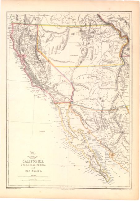
This British-produced map of the Southwest was included in the January 31, 1858 Sunday Supplement to the Weekly Dispatch newspaper and then incorporated into the popular Weekly Dispatch Atlas. The map extends above California's northern border to Cape Blanco and east to the continental divide and Rio Grande valley. The large Utah Territory extends from California to the continental divide, occupying all of today's Nevada and much of Colorado. New Mexico Territory stretches from California to beyond the Rio Grande valley, containing today's Arizona and parts of Nevada and Colorado. The settled areas are presented in good detail and numerous Indian tribes, forts, and watersheds are located. Several unnamed wagon roads or trails are delineated, as are the Old Spanish Trail, and the railroad survey across New Mexico Territory. The map includes much of northern Mexico and the Baja peninsula. Topography is shown through hachure. Wheat says, "This map is an excellent representation of the country."
References: Wheat (TMW) #942.
Condition: B
Original outline color. There are a few tiny spots in the blank margins and a tear entering 2.2" into the blank ocean at left, repaired with archival tape. There are remnants of hinge tape on verso.