Catalog Archive
Auction 142, Lot 280

"Gulf Production Company Postal - Pipe Line - Railway - and Index Map of the State of Texas",
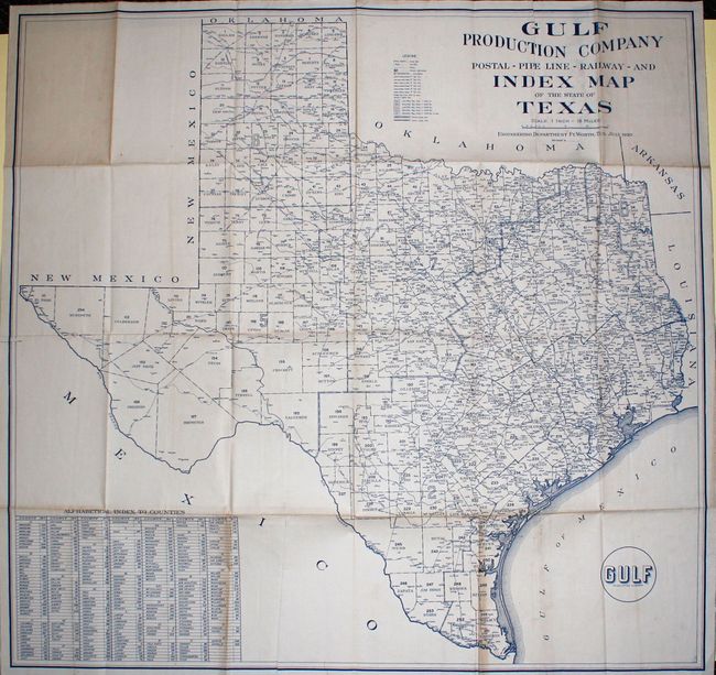
Subject: Texas

Period: 1920 (dated)

Publication:

Color: Printed Color

Size:
43 x 41.2 inches
109.2 x 104.6 cm
Download High Resolution Image
(or just click on image to launch the Zoom viewer)

This large, folding map of Texas was produced by the Gulf Production Company. The map lists 258 counties at lower left with a key at top listing post offices, railroads, and county seats. Curiously, the map legend lists several different types of oil pipeline, but none are drawn on the map. A very rare map, issued during the great oil boom of the early 20th century.

References:

Condition: B+

Light toning along a few folds, else a very nice example.

Estimate: $400 - $500

Sold for: $300

Closed on 11/28/2012

Archived