Subject: New York City, New York
Period: 1866-83 (circa)
Publication:
Color: Hand Color
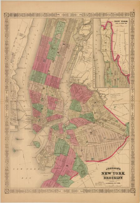
A. Johnson's New York and Brooklyn, by A. J. Johnson, dated 1866, (16.7 x 23"). Covers Manhattan from the Battery to Central Park with the northern portion of the island in an inset at upper right. Shows streets, docks and numerous ferry routes. Condition: Original color with light toning and a centerfold separation at left that just passes the neatline that is closed on verso with archival tape.
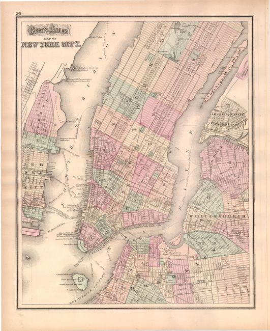
B. Gray's Atlas Map of New York City, by O.W. Gray, circa 1883, (12.2 x 15"). Displays Manhattan from the Battery to Central Park, including the Brooklyn Bridge which here is named simply Suspension Bridge. The verso depicts the eastern side of the state of New York. Condition: Original color with light toning along the edges of the sheet.
References:
Condition: B+
See descriptions above.