Subject: Washington, D.C.
Period: 1900-01 (dated)
Publication:
Color:
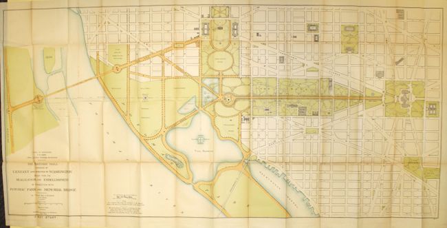
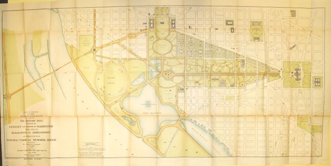
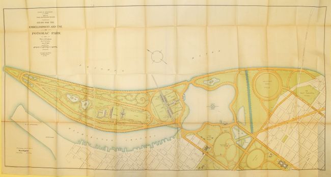
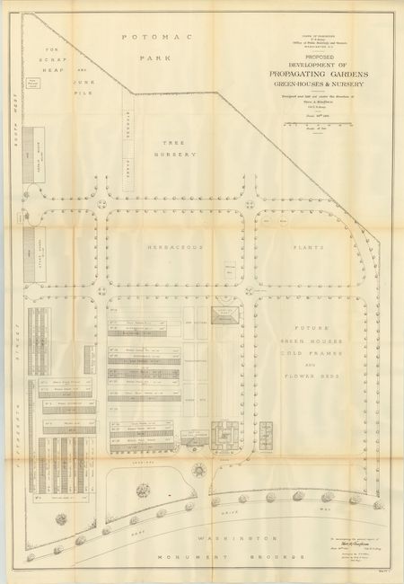
This rare set of maps was drawn by Col. Theodore Bingham, who headed the Office of Public Buildings and Grounds (including the White House). Bingham was tasked with improving the area between the Washington Monument and the Tidal Basin, and these plans represent his proposals. The maps are filled with designs for gardens, nurseries, and scenic drives. In 1908, Congress allocated funds for a riverside drive from the basin inlet to 26th Street, and extended North B Street (the future Constitution Avenue) west as a park roadway to the Potomac. The Tidal Basin is the home to the National Cherry Blossom Festival, which commemorates the 1912 gift of 3,000 cherry trees from Mayor Yukio Ozaki of Tokyo to the city of Washington, DC.
A. The Historic Mall Designed by L'Enfant and Approved by Washington Study for its Realization and Embellishment in Connection with Potomac Park and Memorial Bridge, 1900, printed color (59.8 x 28.4").
B. The Historic Mall Designed by L'Enfant and Approved by Washington Study for its Realization and Embellishment in Connection with Potomac Park and Memorial Bridge, 1900, printed color (59.5 x 27.7").
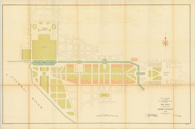
C. The Mall as Proposed by Pierre L'Enfant 1790 (from the Original), 1900, printed color (37.7 x 24.4").
D. Study for the Embellishment and Use of Potomac Park, 1900, printed color (53.8 x 26.8").
E. Proposed Development of Propagating Gardens Green-Houses & Nursery, 1901, black & white (27.5 x 40.1").
References:
Condition: B+
There are a number of splits at fold intersections and some light toning along a few folds.