Subject: Connecticut
Period: 1838 (dated)
Publication: HR Doc 252, 25th Cong., 2nd Sess.
Color: Black & White
Size:
29 x 34.5 inches
73.7 x 87.6 cm
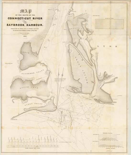
Large map showing nice details of the waters in the vicinity of Saybrook. The coastal features are well defined and the street grid for Saybrook locates numerous buildings along its main street. The famous lighthouse is clearly shown on the western side of the mouth of the Connecticut River. At Griswold's or Eastern Point a single apple tree is drawn and labeled "Leaning Apple tree." Locates Saybrook Point, Lines (Lynde) Point, Great Island, Kelly's Island and numerous sounds. This fine lithographic map is a reduced version of the survey map by J.W. Adams and was made under the direction of Capt. W.H. Swift. Drawn by Washington Hood and M.H. Stansbury. Hood and Stansbury were destined for future fame. Engraved by W.J. Stone. Map is bound into the original 10 pp. report.
References:
Condition: B
There is a binding tear that extends 2" into the blank space of the map which is closed on verso with archival tape. There are a few tiny splits at fold intersections and some light foxing and offsetting. Issued folding.