Subject: Colorado
Period: 1906 (dated)
Publication:
Color: Printed Color
Size:
39 x 28.5 inches
99.1 x 72.4 cm
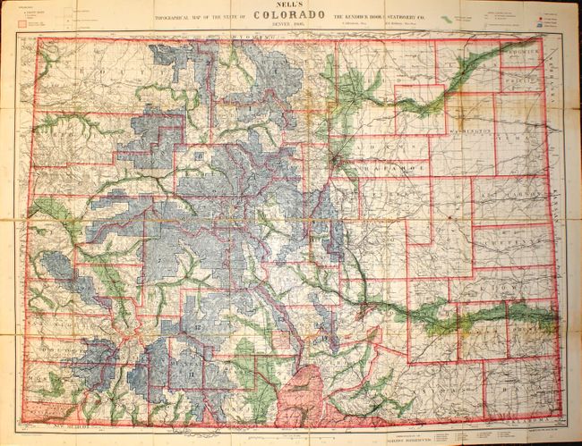
This highly detailed pocket map by Louis Nell "has been complied from all available surveys in existence, it is consequently the most complete and accurate one ever published, and shows all the information useful to settlers, miners and travelers." The map is fully engraved with virtually no area left untouched by the engraver and is drawn on a scale of 10 miles per inch. Beautifully colored to indicate Forest Reserves (fourteen), agricultural lands, timber reserves, watershed and creeks. Locates all towns, villages, settlements, mining areas, railroads, townships, and has contour lines at 1000' intervals.
Nell came to Colorado in the mid-1870s as a topographical assistant to George Wheeler. Nell enjoyed the area so much that he settled there and published a series of maps of the state beginning in 1880. His detailed maps captured the rapid development of the area, including the great Silver Boom during the 1880s-90s.
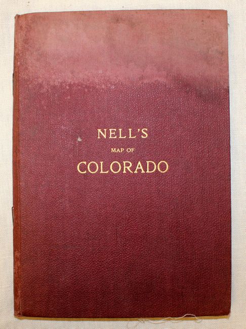
The map is dissected, backed in linen, and folds into red gilt stamped cloth covers and includes 12 pp. of information on Colorado; populations, highest peaks, and the routes and distances of numerous railways.
References: Brown (Portolan - Spring 2019) pp. 47-53.
Condition: B+
There is some light damp staining along two folds at right, and one tiny area of loss along one of the folds at lower right. Front cover is faded at top with a few stains on the back cover.