Subject: San Francisco, California
Period: 1869 (dated)
Publication:
Color: Hand Color
Size:
17.5 x 28 inches
44.5 x 71.1 cm
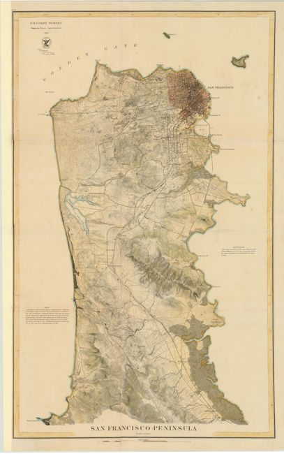
A very detailed map that shows the peninsula from the location of today's San Francisco International Airport (here labeled Milbrae Station), and up to the city of San Francisco. The San Francisco and San Jose Railroad is shown leading into the city. The Cliff House at Pt. Lobos, the Presidio, Mission de Dolores, the large Green House Race Course, and many other interesting points of interest are noted. There is excellent detail of the city's street layout with the islands of Alcatraz and Yorba Buena detailed. Many coastal features are listed, including Point San Pedro, Fort Point, Black Point, Point San Quentin, Hunter's Point, Sierra Point and Point San Bruno. Remarkable detail for this period.
References:
Condition: B
Issued folding, now pressed. Backed in tissue to repair a number of fold separations, small holes at fold intersections, and tears. There is one small unrepaired tear in an unengraved area in the San Francisco Bay. Remargined at left to accommodate framing.