Subject: Virginia, Kentucky
Period: 1850 (dated)
Publication:
Color: Hand Color
Size:
14 x 11.7 inches
35.6 x 29.7 cm
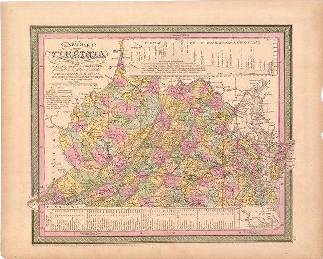
A. A New Map of Virginia with its Canals, Roads & Distances from Place to Place.... An attractive map with nice detail of the counties, cities, roads and railways. At top is a profile of the Chesapeake & Ohio Canal. A table at bottom lists Steam Boat Routes - Richmond to Norfolk, Richmond to Washington, Richmond to Baltimore, Wheeling to Pittsburgh, and Wheeling to Cincinnati. The legend identifies canals, railroads, capital cities, leading roads plus distance along roads in miles. Fancy titling and decorative border.
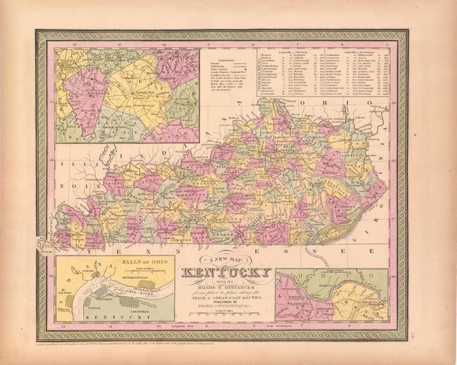
B. A New Map of Kentucky with its Canals, Roads & Distances from Place to Place.... This detailed map of Kentucky illustrates roads and distances from Louisville to Pittsburg and New Orleans along the steamboat routes. Canals, railroads, the state capital, county seats and leading roads are noted. Includes insets of Falls of Ohio, the vicinity of Clarksburg and Maysville, and the vicinity of Lexington. This is one of a few 19th century maps to show Kentucky without Tennessee.
References:
Condition: B+
Original color with light toning and a few small edge tears and chips confined to the blank margins.