Subject: Southern United States
Period: 1861 (dated)
Publication:
Color: Black & White
Size:
30 x 20 inches
76.2 x 50.8 cm
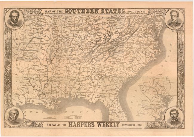
This terrific Civil War map shows good detail of the towns, villages, railroads, and the ship blockade of the south. The title continues along the bottom: "Prepared for Harper's Weekly November 1861." Surrounded by a very decorative border, it features portraits at each corner of Lincoln, Seward, Gen. Scott, and Gen. McClellan. An inset of Washington DC lies at lower right. On the verso are five wood engraved views including "The Valley of the Shenandoah, Virginia", "Our Army at Edwards’s Ferry, on the Potomac, Opposite Leesburg", "Arkansas Troops now under Beauregard, in Virginia", "Our Fleet at the Mouth of the Mississippi…" and "Camp in the Woods near Leesburg, Loudon County, Virginia - Virginia Infantry." An uncommon issue published on November 9, 1861.
References: Stephenson (CW) 14.55; Rumsey #5309.001.
Condition: B
Issued folding with some light offsetting, a few minor spots, and numerous long, clean fold separations that have been closed on verso with archival tape and paper tape.