Subject: Southern United States
Period: 1850 (dated)
Publication:
Color: Hand Color
Size:
11.6 x 14.2 inches
29.5 x 36.1 cm
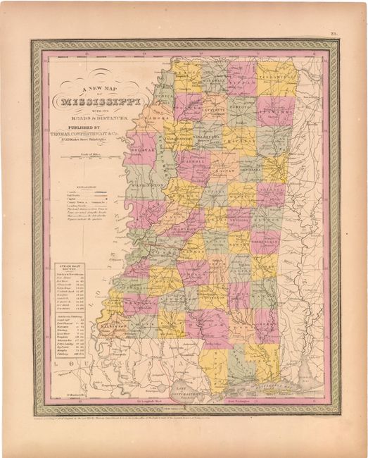
A. A New Map of Mississippi with its Roads & Distances. A very attractive 19th century map of pre-Civil War Mississippi with good detail of the numerous towns and villages, rivers and one railroad linking Jackson and Vicksburg. Some distances are noted between cities along main roads. The table on the left gives the steamboat routes between Natchez and New Orleans, and Natchez to Pittsburg. The map is surrounded by a decorative, scroll border. Condition: Original color with light toning. (B+)
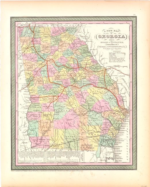
B. A New Map of Georgia with its Roads & Distances. Handsome state and county map with good detail throughout and decorative borders. Locates numerous towns and villages, rivers, canals, and several railroads, principally in the north. Some distances are noted between cities along the main roads. A table gives the steamboat routes between Savannah and Augusta, and Savannah to Charleston. Condition: Original color. (A)
References:
Condition:
See description above.