Subject: Colonial Southeast
Period: 1760 (published)
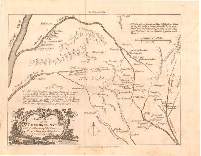
Publication: London Magazine
Color: Black & White
Size:
8.8 x 6.6 inches
22.4 x 16.8 cm
Terrific, uncommon map of the region of Tennessee, western North Carolina and northern Georgia that was drawn "from an Indian Draught." Kitchin most likely used information from John Mitchell's map of 1755 as well. It is one of the earliest printed maps of western North Carolina. The map focuses on the Cherokee lands at the headwaters of the French Broad, Little Tennessee, and Savannah Rivers and was produced as a result of the Indian attacks of 1759-60. Issued in the February 1760 edition of the London Magazine.
References: Cumming (SE) 327; Jolly LOND-183; Sellers & Van Ee #1387.
Condition: B+
Issued folding with light offsetting and toning and a few fold separations confined to the blank margins that have been closed on verso with archival tape.