Subject: Colonial Mid-Atlantic
Period: 1745 (circa)
Publication: Modern History
Color: Black & White
Size:
8 x 10.7 inches
20.3 x 27.2 cm
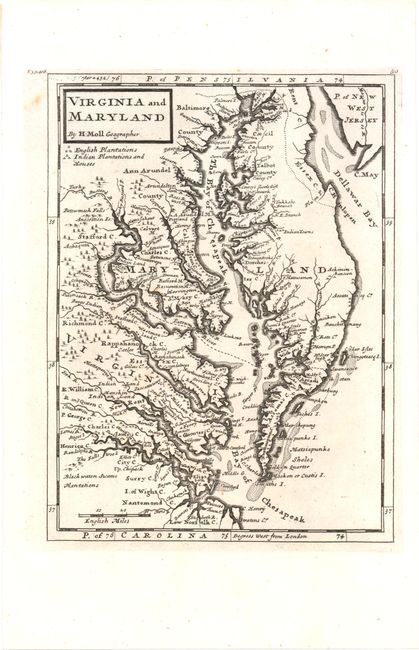
This map of the eastern coast of Virginia, Maryland, and the Chesapeake Bay was based on Augustine Hermann's map of 1673. The map labels counties, towns, water ways, Indian lands, plantations, and provides useful notations such as "the swamp here not passable." A key under the title identifies English plantations and Indian plantations and houses. Published in London in Thomas Salmon's Modern History: or the Present State of All Nations.
References: Stephenson & McKee #II-16; Shirley (BL Atlas) G.SALM-1c #43.
Condition: A
A dark impression on watermarked paper with a couple small, unobtrusive spots.