Subject: United States
Period: 1941 (published)
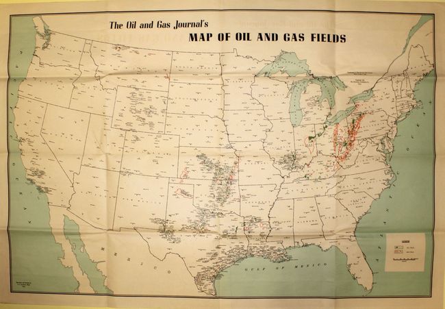
Publication: The Oil and Gas Journal
Color: Printed Color
Size:
45.3 x 30.2 inches
115.1 x 76.7 cm
This large map shows the state of the oil industry a mere six months before the United States joined World War II. The U.S. oil industry was a critical asset for the successful Allied forces as it provided gasoline, toluene (a component in TNT) and various lubricants for machines and weaponry. Detailed at 65 miles per inch, the base map and drafting were completed by E.C. Jacobson of Tulsa, Oklahoma. The legend identifies both oil and gas fields which are shown in color overprinting primarily in the areas from Texas to Kansas, and Kentucky to Pennsylvania. Published on June 5, 1941 by the Petroleum Publishing Company. Blank verso.
References:
Condition: A
Clean, bright example with just a hint of offsetting and a few tiny splits at fold intersections, which is common with large folding maps.