Subject: United States
Period: 1850 (dated)
Publication: Mitchell's New Universal Atlas
Color: Hand Color
Size:
26.3 x 15.4 inches
66.8 x 39.1 cm
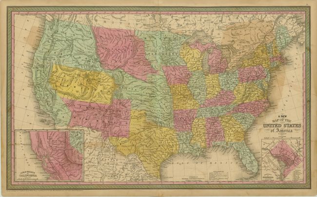
This outstanding map of the United States illustrates early western territorial development with only six large territories covering the region now making up sixteen states. The map is filled with forts, Indian tribes, emigrant roads, early railways, mines, battlefields, salt ponds and a host of other interesting details. Several exploration routes are shown, including those of Fremont, Marcy, and Kearney. Fremont Basin in Utah Territory is bounded by great dividing ridges separating the waters of the Pacific Ocean and the waters of the Great Basin. In the lower corners of the map are insets of the Gold Region of California and the District of Columbia. Dated 1850 but published in 1852.
References: Wheat [TMW] #685.
Condition: B
Offsetting, light toning and a few minor spots.