Subject: Western Canada & United States
Period: 1841 (dated)
Publication: Narrative of the United States Exploring Expedition…
Color: Black & White
Size:
33.8 x 22.8 inches
85.9 x 57.9 cm
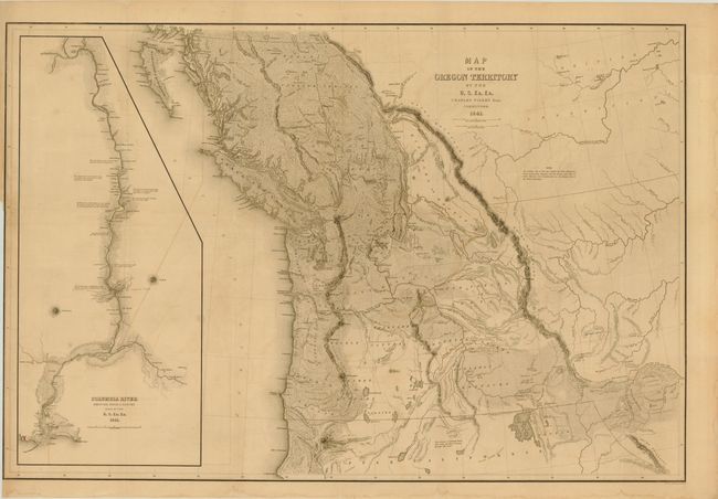
An important map that Wheat says is "really quite extraordinary" and in many respects was the most detailed yet published. The map covers the entire region west from the Black Hills, north to above the 50th parallel and south to the Sacramento River. The United States Exploring Expedition did not enter the Great Basin or any part of the Snake River basin. Instead Wilkes relied on other sources including Jedediah Smith and oral information from Hudson Bay trappers he met on the Columbia River. Although the map contains several errors, the areas of today's Oregon, Washington and Idaho are remarkably well mapped. According to Wheat the map had much influence on later maps of this region. It was a major contribution to American cartography and the most detailed map of the region north of the Sacramento River. Wilkes supported the view of Senator Lewis Linn that the boundary of the American claim should be 54° 40' N, commonly referred to as "Fifty-Four Forty or Fight" dispute with Britain. This map was used to support his claim, which was based on 'topographical' grounds and was instrumental in setting the scene for American interests in the territory. Includes a large inset of the Columbia River from Ft. Walla Walla to its mouth, where one of Wilkes' ships, the "Peacock", was lost on the famous Columbia Bar. This map is considered one of the more important maps of the Northwest region after the Lewis & Clark expedition.
References: Wheat (TMW) #457.
Condition: B+
Light toning and offsetting with a binding trim at left, with minor loss of neatline.