Catalog Archive
Auction 142, Lot 121

"An Authentic Plan of the River St. Laurence, Sillery to the Fall of Montmerenci. With the Operations of the Siege of Quebec, under the Command of Vice-Adml. Saunders & Majr. Genl. Wolfe...", Royal Magazine

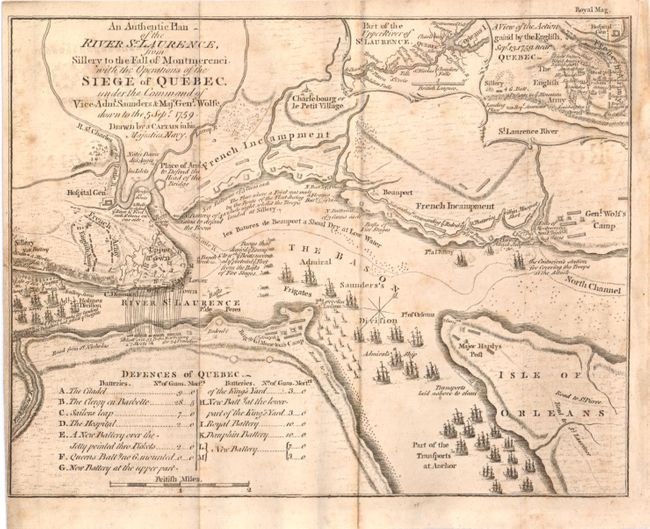
Subject: Quebec, Canada

Period: 1759 (published)

Publication:

Color: Black & White

Size:
9.4 x 7.3 inches
23.9 x 18.5 cm
Download High Resolution Image
(or just click on image to launch the Zoom viewer)

This map details the 1759 "Battle of Quebec" during the French and Indian War. It was issued shortly after the capture of Quebec and shows the positions of the British and French troops and their lines, defensive works, encampments, and numerous warships in the river, some named. This small map delineates rivers, roads, and towns in the vicinity around Quebec and has two small insets at top right. Very detailed on a scale of about one inch per mile. The map is accompanied by the original December 1759 issue of Royal Magazine in which it was issued, which also includes a full page portrait of Major General Wolfe and a hand-colored bird plate.

References: Jolly ROYMAG-6.

Condition: B+

Light offsetting and foxing, issued folding.

Estimate: $400 - $600

Sold for: $150

Closed on 11/28/2012

Archived