Subject: Atlases
Period: 1847 (published)
Publication:
Color: Hand Color
Size:
10 x 13.3 inches
25.4 x 33.8 cm
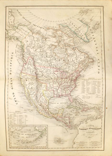
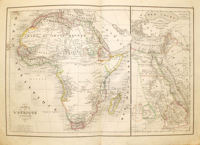
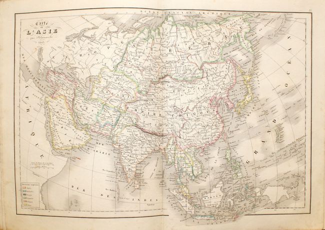
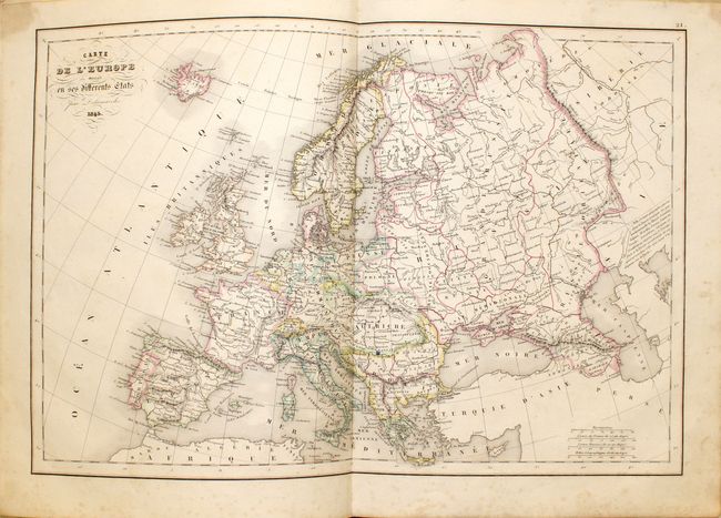
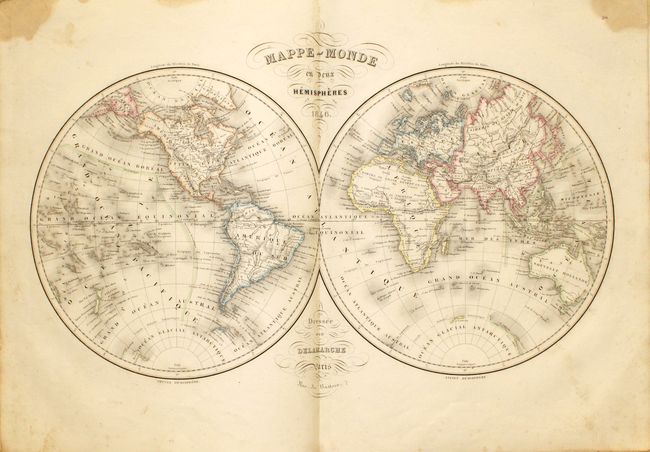
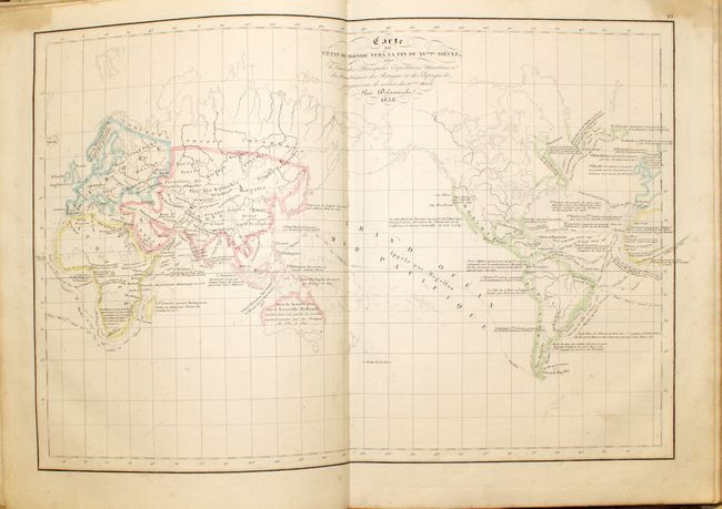
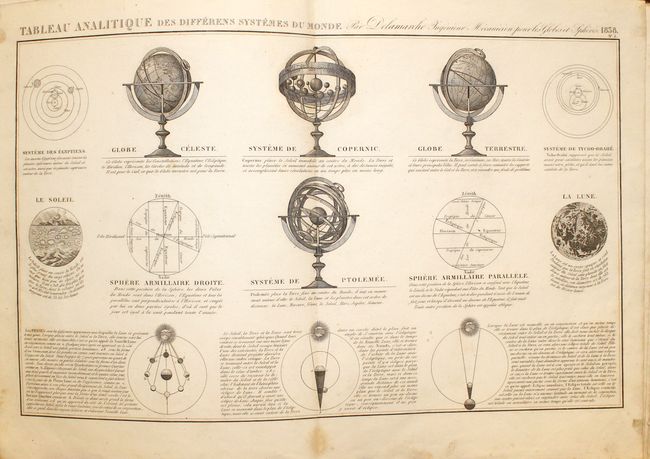
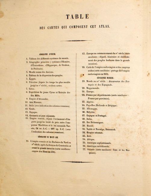
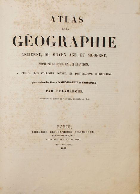
This complete atlas contains 37 double-page maps, including 15 of the ancient world and middle ages, and 22 maps of the modern world. The modern maps include the world [2], Europe, Asia, Africa, North America, South America, Australia and a number of regional maps of Europe. The atlas contains an uncommon North America map featuring an Independent Republic of Texas and early western territorial borders in the United States. The District Oregon ou Colombie extends into present-day British Columbia and is bounded by the Rocky Mountains. Missouri Territory takes in the entire region between Oregon and the Mississippi except for the young states of Missouri, Arkansas and Louisiana. A table at right lists 26 states and the territories of the United States, and another table lists 20 states for Mexico. All of the maps in the atlas are detailed and provide a wealth of information. Maps are dated 1838-1846 and the title page is dated 1847. Folio, quarter calf over marbled boards.
References:
Condition: B+
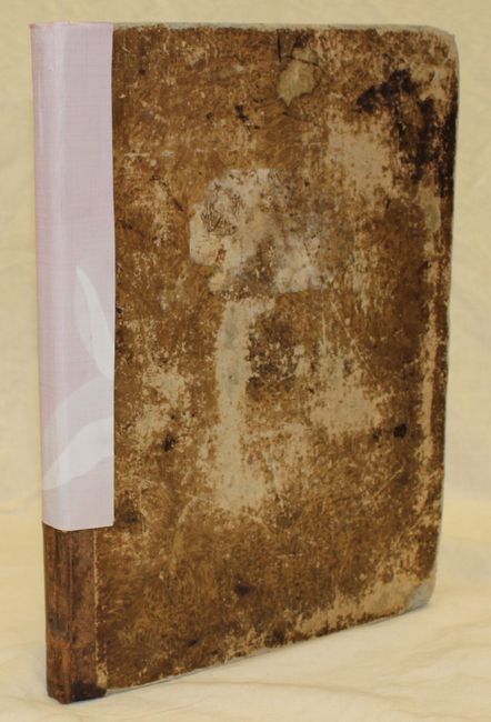
Condition code is for the maps, which are generally very good to good with some light scattered foxing and occasional damp staining, most of which is in the blank margins. Title page is foxed and the previous owner has pasted an engraving on the inside front cover. Covers are heavily worn and bumped, and the spine has been partially reinforced with cloth bookbinding tape.