Subject: Western Africa
Period: 1860 (circa)
Publication:
Color: Hand Color
Size:
36.8 x 25 inches
93.5 x 63.5 cm
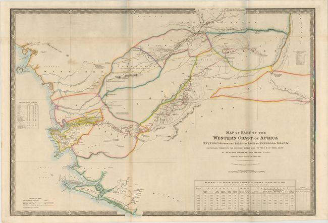
This map of Sierra Leone includes parts of present-day Guinea and Liberia. Sierra Leone was established by former slaves and abolitionists for the resettlement of freed African slaves from both Britain and America. There were several efforts made to develop commercial trade networks, particularly with the highland kingdom of Fouta-Djallon. The routes of several emissaries from Freetown to Timbo are shown, including surgeon Brian O'Beirne, Major Liang, and several others marked with a color key at bottom left. At bottom right is a table with export and import data from 1817 to 1860 as well as census results from 1817 to 1826. The map is surrounded by a decorative keyboard-style border. The map is an important document of the Back-to-Africa Movement that encouraged former slaves to return to their homeland at the beginning of the 19th century.
References:
Condition: B+
Issued folding with original color and minor soiling and a few short tears in blank margins. There is light toning along folds, and several folds have been reinforced on verso with canvas strip.