Catalog Archive
Auction 141, Lot 664
"A Chart of North-West Coast of Borneo from Balambangan to Borneo Proper Survey'd in the Sloop Endeavour by James Barton", Sayer & Bennett
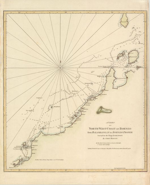
Subject: Borneo, Indonesia
Period: 1780 (dated)
Publication:
Color: Hand Color
Size:
18 x 20.3 inches
45.7 x 51.6 cm
Download High Resolution Image
(or just click on image to launch the Zoom viewer)
(or just click on image to launch the Zoom viewer)