Catalog Archive
Auction 141, Lot 575

"In Notitiam Ecclesiasticam Africae Tabula Geographica", Delisle/Dezauche

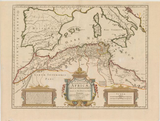
Subject: Northern Africa & Western Mediterranean

Period: 1780 (dated)

Publication:

Color: Hand Color

Size:
24.5 x 19 inches
62.2 x 48.3 cm
Download High Resolution Image
(or just click on image to launch the Zoom viewer)

This boldly engraved map focuses on the regions controlled by the Moors in northern Africa and the Iberian Peninsula in the latter part of the medieval period. The map displays good detail along the north African coast from Morocco to Libya. It also covers the western Mediterranean with the islands of Sardinia, Corsica, and the Balearics. Three decorative cartouches complete the composition. This is the rarely seen issue engraved by Joan Baptiste Liebaux - not the more common Covens & Mortier edition.

References:

Condition: B+

Watermarked paper with a few faint spots.

Estimate: $300 - $400

Sold for: $220

Closed on 9/5/2012

Archived