Catalog Archive
Auction 141, Lot 574
"Carte Topographique des Pays et Cotes Maritimes qui Forment le Detroit de Gibraltar / Topographische Carte der Lander und Kusten Welche die Meer Enge von Gibraltar", Homann Heirs
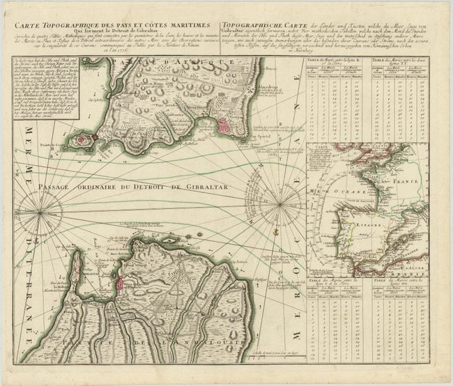
Subject: Gibraltar
Period: 1756 (dated)
Publication:
Color: Hand Color
Size:
22 x 16.5 inches
55.9 x 41.9 cm
Download High Resolution Image
(or just click on image to launch the Zoom viewer)
(or just click on image to launch the Zoom viewer)