Subject: Ukraine
Period: 1680 (circa)
Publication: The English Atlas
Color: Hand Color
Size:
19.8 x 15 inches
50.3 x 38.1 cm
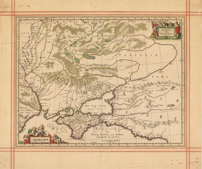
This fine map of the region north of the Black Sea is based on Mercator's cartography. The interior is filled with large forests and mountains. It is embellished with two cartouches surrounded by figures. The plate was originally engraved by Jan Jansson. After his death it was inherited by his son-in-law, known as Jansson-Waesberg, who published it in conjunction with Moses Pitt. This map was published in Volume I of Pitt's The English Atlas, which was initially planned as 12 volumes, but only four volumes were published before Pitt abandoned the project due to debt. The paper on this example has been double red-lined ruled just outside of the plate mark, which was a common embellishment for a royal presentation set.
References: Shirley (BL Atlases) T. PITT-1c.
Condition: B+
Splendid original color with a few gilt highlights on heavy paper and wide, original margins. There is a 1" crack around the largest lake near the centerfold at top, which was caused by the oxidation of the green pigment, and has been closed on verso with archival tape.