Subject: Northern France
Period: 1573 (circa)
Publication: Theatrum Orbis Terrarum
Color: Hand Color
Size:
19 x 13.3 inches
48.3 x 33.8 cm
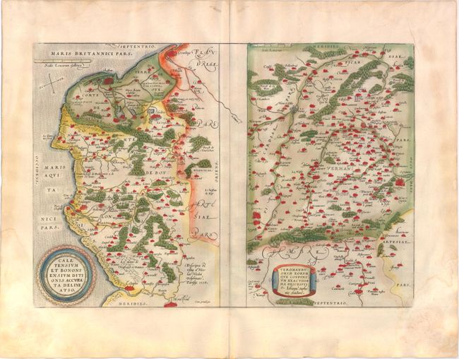
Two maps on a folio sheet. Calentensium covers the coastline between Calais and Estaples in very good detail, based in part on a four-sheet map by Nicolas de Nicolay. Veromanduorum covers a small region surrounding Saint-Quentin in northern France. The cartographical source of the map was Jean de Surhon who received royal privilege to make a map of the region in 1557. Each is covered with tiny forests and cities and has a decorative title cartouche. Dutch text on verso published between 1571-73. This map was replaced in 1598 with a map showing the Veromanduorum region with north at the top.
References: Van den Broecke #44.
Condition: B+
Attractive old color on watermarked paper with light damp stains in wide blank margins, barely entering map at corners. There is some minor creasing in blank margins and a short tear in bottom blank margin. French manuscript writing on verso opposing the Dutch text.