Subject: World
Period: 1816 (dated)
Publication: Stieler's Hand-Atlas
Color: Hand Color
Size:
14 x 11.5 inches
35.6 x 29.2 cm
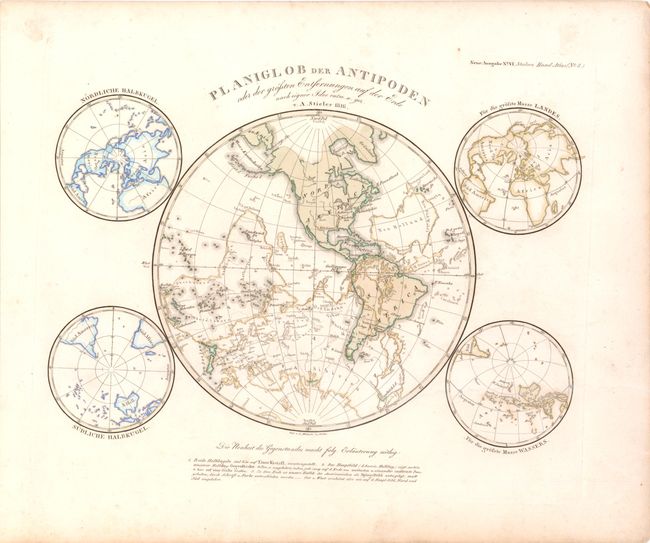
This fascinating and unusual map depicts the western hemisphere overlaid on the eastern hemisphere, with the eastern hemisphere depicted as a mirror image. Overlaying the hemispheres shows the antipodes of each of the land masses on earth - the points on earth that are diametrically opposite to one another. Although most land masses have their antipodes in the ocean, portions of South America have antipodes in China and Southeast Asia, and numerous islands in the Pacific have antipodes in Africa. The antipodes map is surrounded by four smaller hemispheres depicting a north-polar projection, a south-polar projection, the area of earth with the most landmass, and the area of earth with the most water.
References:
Condition: B+
Original color with minor soiling.