Catalog Archive
Auction 141, Lot 328

"Kaart van Het Eiland Aruba Gevolgd Naar de Opmeting in den Jare 1820 Gedaan, Onder Directie van den Kapitein ter Zee W.A. van Spengler en in den Jare 1825 met Verscheidene Nieuwe Bepalingen Verrijkt",
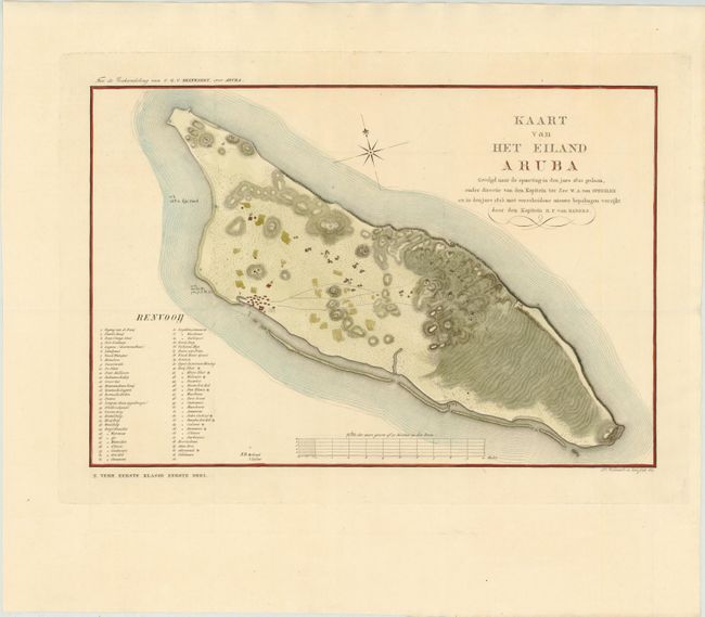
Subject: Aruba

Period: 1827 (dated)

Publication:

Color: Hand Color

Size:
17.4 x 11.7 inches
44.2 x 29.7 cm
Download High Resolution Image
(or just click on image to launch the Zoom viewer)

This rare map of Aruba, one of the Dutch Antilles islands, shows great detail of the topography of the land. Early settlements in Oranjestad and others locations on the island are depicted, along with a numbered key identifying over 60 locations, including areas where gold and silver had been found. The map was based on the explorations of Dutch captains William Augustus van Spengler in 1820 and R. F. van Raders in 1825.

References:

Condition: A+

Issued folding on watermarked paper with wide margins and very minor soiling in blank margins.

Estimate: $1,000 - $1,400

Sold for: $900

Closed on 9/5/2012

Archived