Subject: Galveston Bay, Texas
Period: 1853 (dated)
Publication:
Color: Hand Color
Size:
17 x 14 inches
43.2 x 35.6 cm
The Office of Coast Survey is the oldest U.S. scientific organization, dating from 1807 when Congress directed that a "survey of the coast" be carried out. By 1836, it was called the U.S. Coast Survey and in 1878, the name was changed to the U.S. Coast and Geodetic Survey. Today the Office of Coast Survey is a division of the National Oceanic and Atmospheric Administration NOAA.
The survey teams, composed of civilians as well as Army and Naval officers, charted the nation's waterways and produced a wide array of reports, survey charts, hydrographic studies of tides and currents, astronomical studies and observations, and coastal pilots. These charts are an important record of the changing nature of the nation's coastlines. In additional to coastal charts, the U.S. Coast and Geodetic Survey produced land sketches, Civil War battle maps, and the early aeronautical charts.
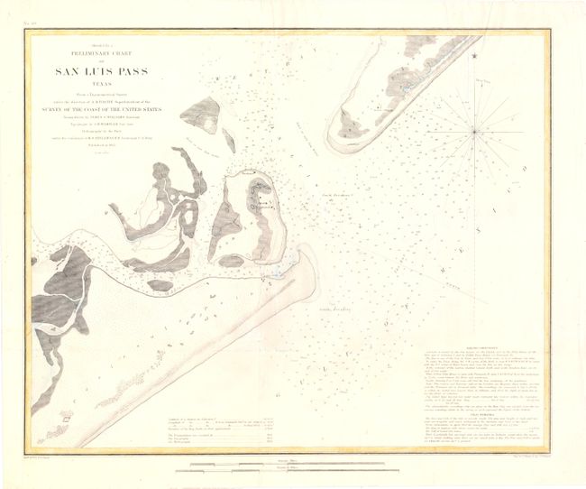
Handsome chart of the entrance to Galveston Bay, noting San Luis Island, Galveston and Mud Island as well as Peninsula Point. The chart notes soundings, sailing directions and tidal effects.
References:
Condition: B
Issued folding, now pressed with a couple of tiny fold separations that have been reinforced on verso with tissue. A binding trim at bottom left has been replaced to accommodate framing, and a 2" binding tear has been archivally repaired.