Subject: Oklahoma
Period: 1890 (dated)
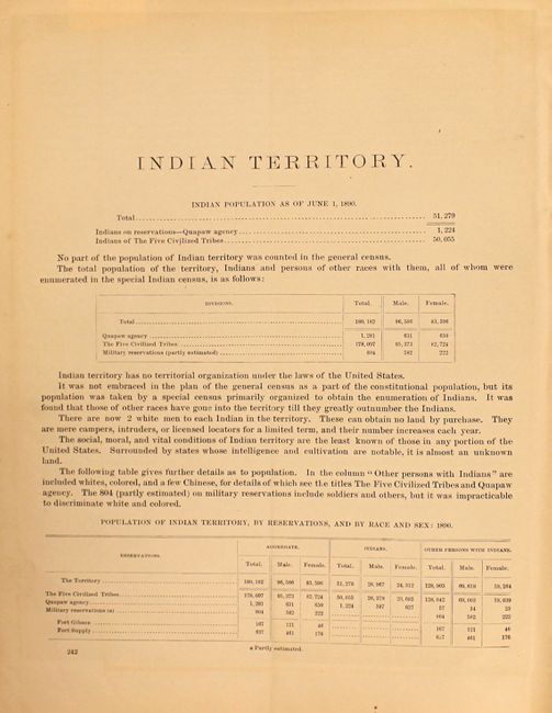
Publication: 11th Census, Report of Indians Taxed and Indians Not Taxed
Color: Printed Color
Size:
29.5 x 22 inches
74.9 x 55.9 cm
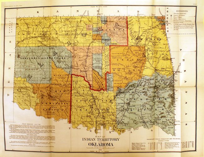
Large, colorful and historically significant map showing the newly created Oklahoma Territory, which was created in 1889. This is possibly the only Census Office map showing the two territories together. Both would clamor for admission to statehood. The Dawes Commission would soon extinguish Indian land titles, which led to eventual statehood for the Oklahoma Territory. There is documentary backup for the Indian titles in each of the tribal areas and marginal notes with historical information on the various Indian Lands. Scale of 12 miles to the inch, legend in upper right. Lower right box lists the railroads authorized to operate in Indian Territory. This is the rarer issue from the 11th Census and should not be confused with the more common General Land Office issue.
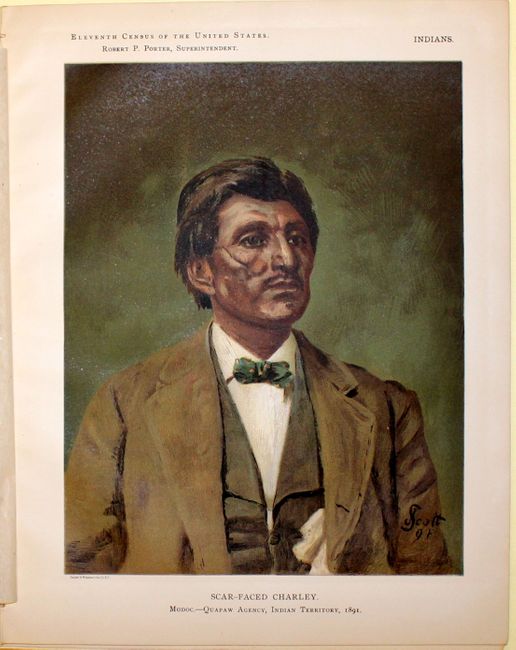
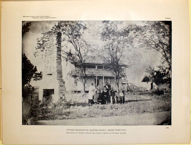
Included with the map is the rarely seen accompanying text of the 11th census discussing Indian Territory. 76 pp. with 19 photographic plates including a fascinating color plate of Scarfaced Charley.
References:
Condition: A
The map is disbound from the report and in near fine condition. The report has several loose pages and minor toning.