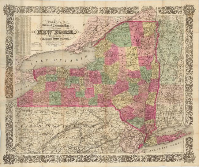
Subject: New York
Period: 1865 (dated)
Publication:
Color: Hand Color
Size:
29 x 23.5 inches
73.7 x 59.7 cm
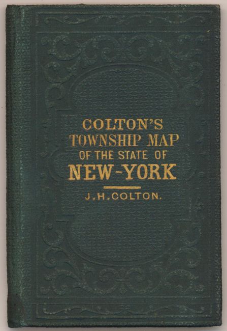
This large pocket map, printed on banknote paper, is dated 1852 in the copyright notice, but this example is updated to 1865, as indicated in the title. Counties are delineated with information on villages, towns, roads, canals, and a large number of named railroads. A table of "Statistics of Population" at upper left shows a population increase of nearly 1.5 million people between 1840 and 1860. Decorated with a wide and elaborate floral border. The map was drawn by George W. Colton and printed by H.P. Cooper. Folds into original green blind-stamped, cloth boards (3.8 x 5.5") with gilt title and embossed elements.
References:
Condition: B+
Original hand coloring with a few short splits at fold intersections and some isolated foxing. There is some light toning on a few folds and where the map is attached to its covers.