Subject: New York
Period: 1854 (dated)
Publication:
Color: Hand Color
Size:
24 x 19.5 inches
61 x 49.5 cm
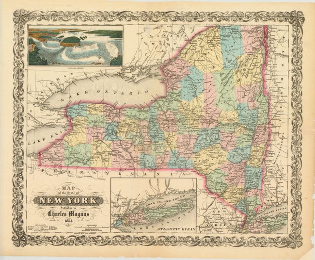
This scarce piece is a dramatic and decorative map of the state that includes a beautiful birds-eye view of Niagara Falls at upper left. The map is colored by county with much detail of towns and villages, canals, railroads, wagon roads, watershed and more. A second inset shows all of Long Island on the same scale as the main map. The titling is in fancy text with flourishes and banknote-style pattern behind. A wide, handsome border surrounds. Blank verso. An uncommon map by Charles Magnus, 12 Frankfort Str. New York. The map appears to have been issued separately or perhaps in a pocket map format although there is no overt evidence of it having been attached to covers.
References:
Condition: B+
The map image, color and impression are fine. The map is on thin paper with one small hole in Seneca county that has been repaired on verso with archival materials. There are a few short edge tears, some of which are closed on verso with archival material.