Catalog Archive
Auction 141, Lot 241

"[Eastern Sheet] Post Route Map of the States of Michigan and Wisconsin with Adjacent Parts of Ohio Indiana Illinois Iowa and Minnesota", U.S. Government
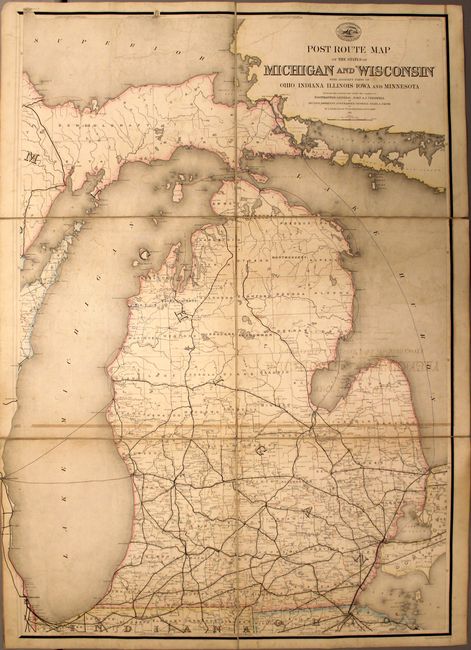
Subject: Michigan

Period: 1871 (dated)

Publication:

Color: Printed Color

Size:
29.3 x 41 inches
74.4 x 104.1 cm
Download High Resolution Image
(or just click on image to launch the Zoom viewer)

This is the eastern sheet of a very early two-sheet map showing the postal routes in upper and lower Michigan as well as portions of northern Indiana and Ohio. This large scale map of the area (five miles to the inch) shows the various postal routes, towns and railroad network in the state. Drawn by W.L. Nicholson and designed and constructed for Postmaster General John A.J. Creswell. Dissected and backed with linen and folds into marbled self-wrappers.

References:

Condition: B

Moderate offsetting with some pencil notations in the image and minor soiling. There is also a small hole and another 2" separation in the linen between the map sections.

Estimate: $275 - $350

Sold for: $200

Closed on 9/5/2012

Archived