Subject: Boston, Massachusetts
Period: 1910 (circa)
Publication:
Color: Printed Color
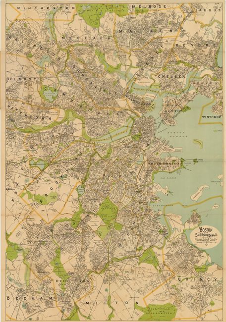
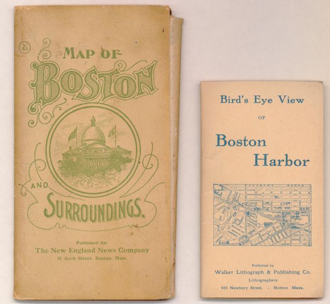
A. Boston and Surroundings, (27.5 x 41"). This is a large-format folding map of the greater Boston area. It is highly detailed showing street names, bridges, railroads, parks and docks. Published by the Walker Lithographic & Publishing Co., 400 Newbury St, Boston on behalf of the New England News Company. Folds into tan paper wrappers measuring 4 x 8". Condition: There are numerous splits at fold intersections, a few pencil notations and spots in the image and light toning. (B)
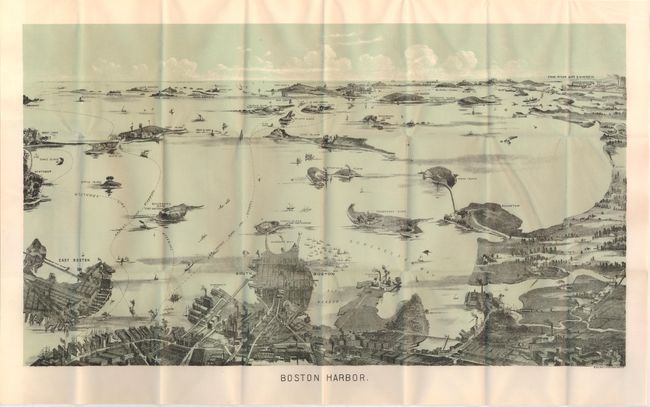
B. Boston Harbor, (21 x 12"). This is a terrific bird's-eye pocket map of the region that was produced for the tourist trade. The map is a fine single-color chromolithograph that folds into paper covers entitled "Bird's-Eye View of Boston Harbor." The map extends from the coastal area of East and South Boston across the water to the main ship channel and the Boston Light. It locates Winthrop, Thompson's Island, Moon Island, Deer Island, Nahant, Green Island, the Brewster Islands, Strawberry Hill, Fort Warren, and Hough's Neck. The Fore River Ship & Engine Co. is on the distant horizon. Steamer routes to Nantasket Beach, Nahant, Winthrop are identified. On the back cover is an extensive list of maps available from Walker Lith. & Pub. Co. This map, as listed, originally cost 10 cents. Walker's maps were often sold as advertising maps under another name, most notably by the Union News Co. Condition: There are a few short splits at fold intersections, else very good. (B+)
References:
Condition:
See description above.