Subject: Portland, Maine
Period: 1870 (dated)
Publication:
Color: Black & White
Size:
30 x 22.5 inches
76.2 x 57.2 cm
The Office of Coast Survey is the oldest U.S. scientific organization, dating from 1807 when Congress directed that a "survey of the coast" be carried out. By 1836, it was called the U.S. Coast Survey and in 1878, the name was changed to the U.S. Coast and Geodetic Survey. Today the Office of Coast Survey is a division of the National Oceanic and Atmospheric Administration NOAA.
The survey teams, composed of civilians as well as Army and Naval officers, charted the nation's waterways and produced a wide array of reports, survey charts, hydrographic studies of tides and currents, astronomical studies and observations, and coastal pilots. These charts are an important record of the changing nature of the nation's coastlines. In additional to coastal charts, the U.S. Coast and Geodetic Survey produced land sketches, Civil War battle maps, and the early aeronautical charts.
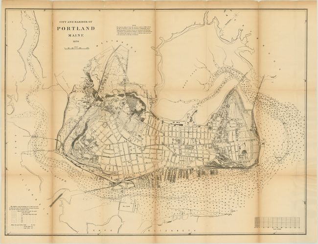
This map of the city of Portland and surrounding area shows nice detail of city streets, buildings and wharves with numerous soundings located with contour lines. The map is reduced from the surveys made in 1868 and 1869 for the City of Portland.
References:
Condition: C+
Issued folding with light toning along the folds. The sheet was severed along the left fold and rejoined with archival tape on verso. There are a number of other fold separations, some of which are closed on verso with archival material.