Subject: Florida
Period: 1850 (dated)
Publication: Mitchell's New Universal Atlas
Color: Hand Color
Size:
11.6 x 14.4 inches
29.5 x 36.6 cm
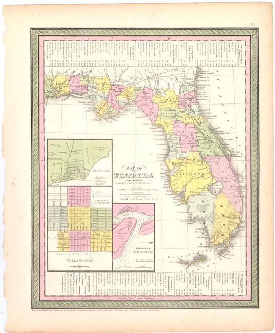
This is a very informative early map of the state of Florida showing only 26 organized counties. Settlement in southern Florida does not extend below Forts Jupiter, Dulaney and Thompson except for Key Biscayne. Three insets show the vicinities of Pensacola, Tallahassee and the Harbor of St. Augustine. The legend locates canals, railroads, and roads. There are two short railroads linking Tallahassee with St. Marks, and St. Josephs with Iola. County devolvement suggests a date of 1849 or 1850, in agreement with the copyright notice below the neatline. Benton county was renamed Hernando in 1850, and in 1851 Dade county was de-organized: neither event included on this map.
References:
Condition: B+
Original color and strong impression with a minute pinhole only visible when held to light and a few minor spots. The left edge of the sheet is slightly tattered, far from the map image, where the sheet was removed from the binding.