Subject: Colorado
Period: 1874 (published)
Publication: Mission of the North American People, Geographical, Social and Political
Color: Hand Color
Size:
20.8 x 20.3 inches
52.8 x 51.6 cm
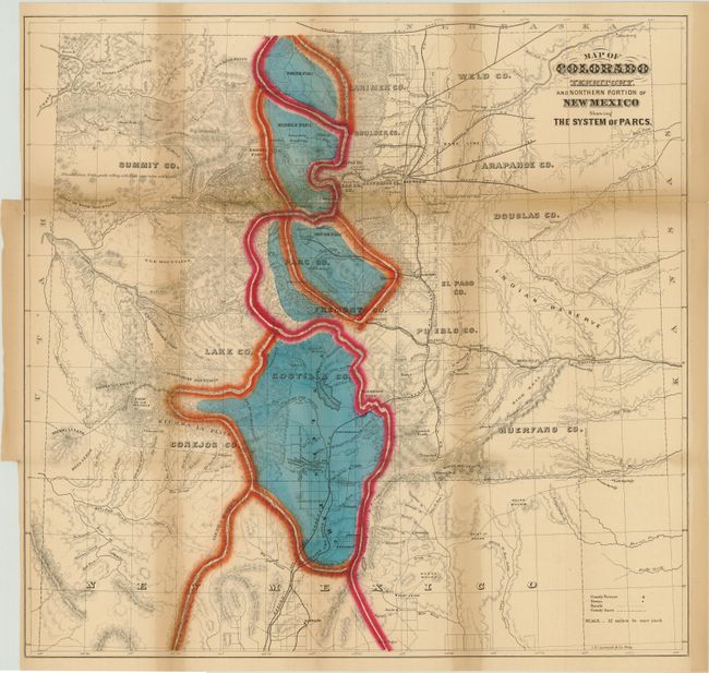
William Gilpin was the first governor of the territory of Colorado and a proponent of the concept of Manifest Destiny and of a transcontinental railway. This map is based on a similar map issued by Jacob Monk in 1865 and shows all of Colorado and part of northern New Mexico. It illustrates the continental divide and four major Parcs; North, Middle, South and San Luis [Valley]. Lesser parks are also noted, as are the status of public land surveys, military posts, mines, and towns. Locates the Denver and Rio Grande, Joseph & Denver, Kansas Pacific, Leavenworth & Denver, Union Pacific, and Denver Pacific railroads, plus a few others. A fascinating map that should be part of any Colorado collection. Printed by the J.B. Lippincott company. This map comes from the second revised edition of the book.
References:
Condition: B
Very strong original hand color and crisp impression. Folding as issued with toning along the folds and separations along folds, some of which have been closed on verso with archival tape. Previously bound into book from center panel, resulting in two short tears from binding trims with just one tear barely passing the neatline.