Subject: Southwestern United States
Period: 1863-64 (published)
Publication: Illustrated Family Atlas
Color: Hand Color
Size:
22 x 15.5 inches
55.9 x 39.4 cm
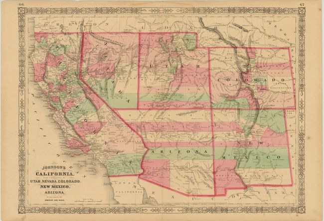
This is the late 1863 - early 1864 edition in this series of maps. Arizona still has the county configurations of the old New Mexico Territory, with the addition of Castle Dome and Ewell counties in the south. The Utah/Nevada border is now at 115°. This is a completely new plate with many changes in watershed and mountain detail with several of the earlier notations removed. Details the U.S. Mail routes, the Emigrant roads to California, the proposed railroad route through Utah, Nevada and California, and the Pony Express trail.
References:
Condition: B+
Original color with light, pleasant toning. There is an archivally repaired centerfold separation at bottom that enters 2" into the map image, a few minor spots in the image, and a few edge tears confined to the blank margins.