Subject: Colonial South, Florida
Period: 1765 (circa)
Publication:
Color: Black & White
Size:
8.8 x 7.3 inches
22.4 x 18.5 cm
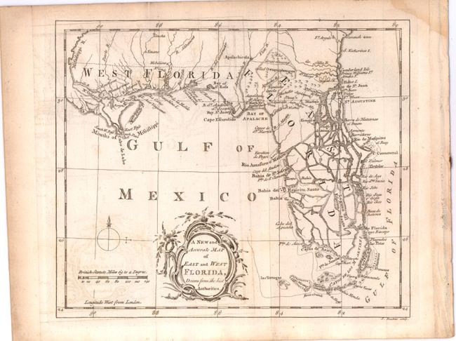
This interesting chart covers Florida and the region as far north as Savannah. West Florida extends to the Mississippi River to include New Orleans. It shows the entire peninsula as an archipelago that is heavily fragmented with numerous large waterways that communicate between the Gulf and the Atlantic Ocean. Tampa Bay is here named Bahia del Espiritu Santo. The map also shows the keys and extends to include las Tortugas. Rococo-style title cartouche, distance scale with British Statute Miles, and simple compass rose with fleur-de-lys decorate the map. This map is very similar to one of the same title that was issued in the London Magazine in 1765.
References: Seller & Van Ee #1620; cf Jolly LOND-243.
Condition: B+
Light offsetting with a couple of faint spots in the image and a dampstain in the upper right corner, not affecting map. Issued folding.