Subject: United States
Period: 1861 (dated)
Publication:
Color: Hand Color
Size:
23.5 x 17 inches
59.7 x 43.2 cm
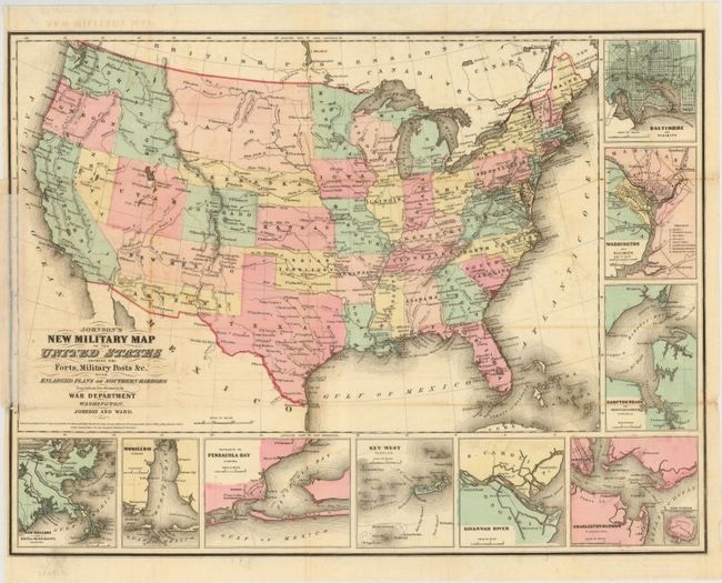
This is the more desirable issue of this Civil War period map, with the state and territory borders instead of the Military Districts. The large western territories include Dakota, which incorporates present-day Montana and part of Wyoming, Nebraska with its western border on Washington and Utah, Washington with the inverted "L" shape encompassing present-day Idaho, a very narrow Nevada, and Arizona located below New Mexico Territory. Hundreds of military forts are located. The map has at bottom and right nine inset plans of the major towns and harbors including Hampton Roads, Charleston Harbor, Key West, Baltimore and Washington. Copyright date 1861, but published circa 1863. Printed on thin banknote-style paper.
References:
Condition: C+
Issued folding with a number of small fold separations that have been partially closed on verso with paper tape along with a few small tears in the image, a few spots along the folds, and some tissue along the left neatline on recto.