Subject: United States
Period: 1853 (dated)
Publication:
Color: Hand Color
Size:
17.7 x 10.6 inches
45 x 26.9 cm
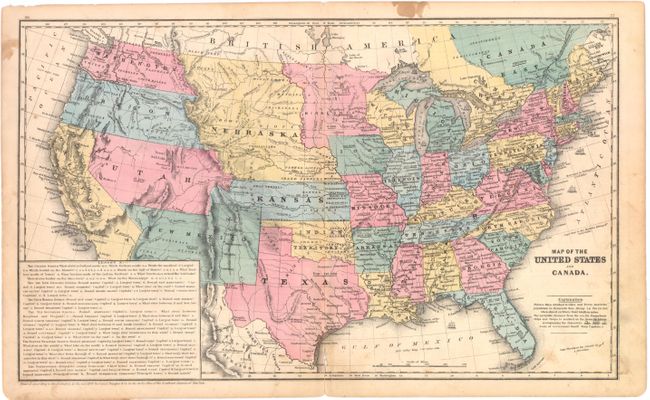
A great school atlas map with full original hand coloring to delineate the early territorial borders in the west. The territories of Washington and Oregon extend to the Continental Divide, Utah is a huge area that extends from California to the Continental Divide. New Mexico Territory occupies all of today's Arizona and part of Colorado and the border with Mexico reflects the Gadsden Purchase. A huge Nebraska extends between the Continental Divide and Minnesota and is bounded by Canada and Kansas. A large Gold Region is shown in north central California. Most states and territories are labeled with their population. Large panel at lower left is a teacher's aid with questions. Covers only the region of Canada along the U.S. boundary.
References:
Condition: B
Original color with a centerfold separation at bottom that enters 1" into map image with tiny loss of image, some light soiling, and a few stains primarily confined to the blank margins.