Subject: Colonial Great Lakes
Period: 1778 (published)
Publication:
Color: Hand Color
Size:
16.5 x 12 inches
41.9 x 30.5 cm
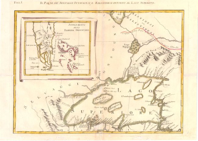
This is one sheet of Zatta's version of John Mitchell's epic and important map of the United States. The whole map was titled "Le Colonie Unite dell' America Settentrle" and was published as a set of twelve individual maps. This sheet depicts Lake Superior, based on the Bellin model. The lake is shown with the imaginary and persistent island of Philippeaux, and the Keweenaw Peninsula is crudely delineated and named Trasporto. A large inset "Supplemento alla Florida Orientale" shows the tip of southern Florida and the Bahamas. The title appears above the top border and translates, "The Country of the Savage Ottowas and Christineauz on the shores of Lake Superior."
References: Kershaw #980; Sellers and Van Ee #163.
Condition: B
Lovely old color with minor refreshing on watermarked paper with some white spots in the image. There are a number of worm tracks primarily confined to blank margins, that have been repaired with old paper on verso, with a small amount of neatline and title in facsimile.