Subject: Atlases
Period: 1780 (circa)
Publication:
Color: Black & White
Size:
8.3 x 10.5 inches
21.1 x 26.7 cm
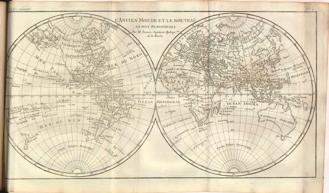
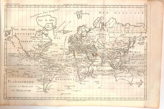
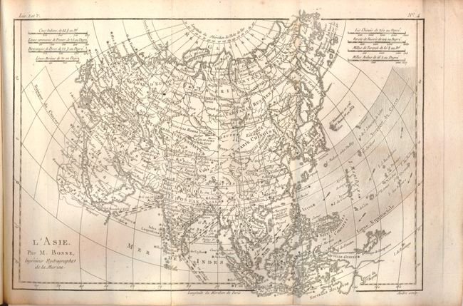
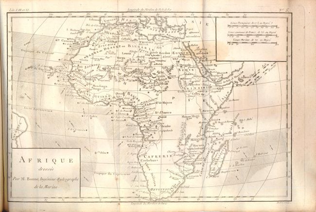
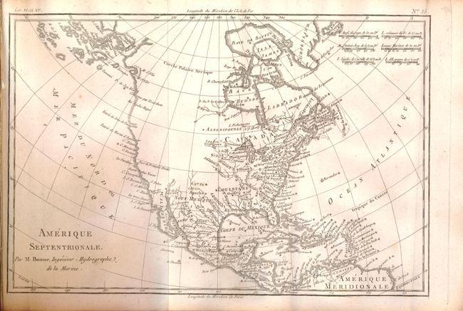
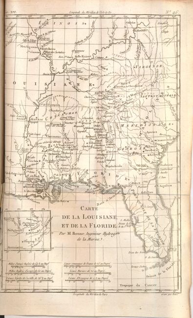
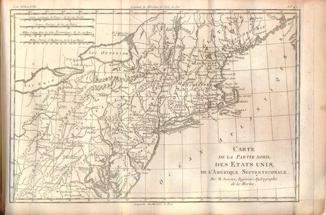
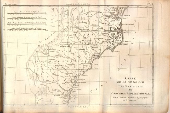
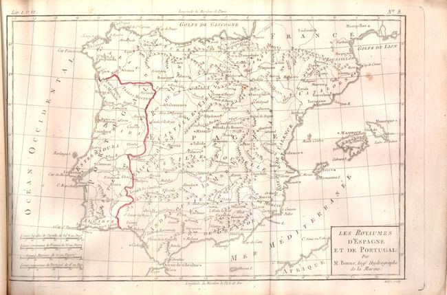
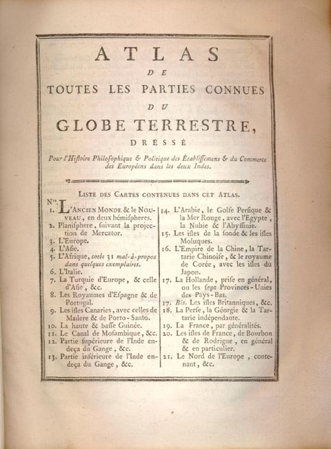
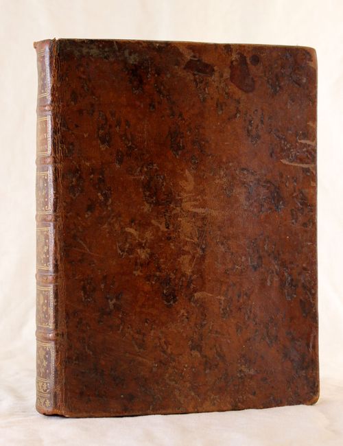
This is the atlas volume for Abbe Raynal's "L'Histoire philosophique et politique des etablissemens et du commerce des Europeens dans les deux Indes." The atlas is complete and is filled with Bonne's well drawn maps and charts engraved by Andre. Included are a title page, list of maps, Analyse Succincet de Cet Atlas (28pp), 49 maps and charts, and numerous folding statistical tables. The map contents include two world maps, Europe, Asia, Africa, ten related to Europe, three related to Africa, two related to India, Arabia, the East Indies, the Moluccas, China, Persia, Philippines, Russia, six related to South America, several Caribbean charts, plus North America and those related: Mexico; le Nouveau Mexique; Terre-Neuve, Acadia…; Occidentale du Canada; Louisiana & Florida; Partie Nord des Etats Unis; and Partie Sud des Etats Unis. In original brown leather binding with gilt tooling and title on spine. The atlas volume did not carry any publication information on the title pages, but was known to be published in 1780.
References:
Condition: B+
Maps and text are all very good to fine, with occasional spots, light toning along the folds, or a short binding tear. One of the maps is partially hand colored in outline (Spain & Portugal), but the rest are uncolored. Maps are identified on verso in red pencil. The covers are somewhat worn and stained but overall very good, and the hinges are starting.