Catalog Archive
Auction 140, Lot 828

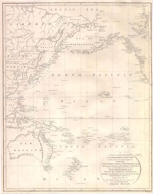
"A New & Accurate Chart of the Discoveries of Captn. Cook & other Later Circumnavigators: Exhibiting the Whole Coast of New South Wales, Shewing the Situations of Port Jackson, & Norfolk Island, where the New Settlements are Formed…", Guthrie, William

Subject: Pacific Ocean

Period: 1795 (circa)

Publication:

Color: Black & White

Size:
13.3 x 16.8 inches
33.8 x 42.7 cm
Download High Resolution Image
(or just click on image to launch the Zoom viewer)

This map illustrates the discoveries of eighteenth century exploration in the Pacific. Part of the southern coast of Australia is conjectural, and Diemans Land is still connected to the mainland, which wasn't disproved until Flinders and Bass circumnavigated Tasmania in 1798-99. Numerous other islands in the South Pacific are only partially delineated. The northwest coast of North America also depicts recent discoveries, with several small gaps in the coastline. This map was originally published by Alexander Hogg in A New, Complete, and Universal Collection of … Voyages and Travels… Engraved by T. Conder.

References:

Condition: B

Issued folding, now pressed with light offsetting and a minor spot of soiling. There is an archivally repaired tear that enters 2.5" into map at right with a narrow right margin. Backed in Japanese tissue.

Estimate: $300 - $400

Sold for: $350

Closed on 5/23/2012

Archived