Subject: Pacific Ocean
Period: 1721 (circa)
Publication:
Color: Black & White
Size:
22.8 x 17.3 inches
57.9 x 43.9 cm
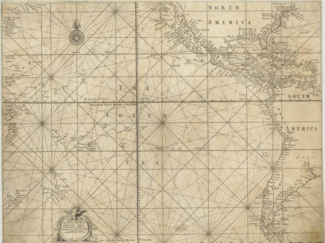
This scarce sea chart is one of the first charts of the Pacific published in England. The map is based on John Seller's A Chart of the South Sea from 1675, which was based on the work of Dutch cartographers of the time. The map depicts the majority of North America and South America, with the names of towns filling the coastlines. The island of California is prominently shown, and Tierra del Fuego is correctly shown as an island with the Magellan Streights named. In the upper left corner, the spurious coastline of Compaignes Land appears north of Japan. The Ilhas de Ladrones (islands of thieves) are detailed along with a plethora of islands in the central Pacific. In the vicinity of Australia, partial coastlines of Carpentaria, Tasmania and New Zealand (Staten Land) appear, documenting the Dutch discoveries in the region. Samuel Thornton's imprint has been removed from the title cartouche, but can still be faintly seen.
References: Suarez, p. 108-109; McLaughlin #201.
Condition: B
Watermarked paper, trimmed to neatlines, and light soiling. There are two minute worm tracks at bottom center. There is some expert paper restoration in a few areas along edges, with the bottom right-hand edge remargined and a small amount of neatline in facsimile at bottom right.