Subject: Western Hemisphere
Period: 1818 (dated)
Publication:
Color: Hand Color
Size:
20.5 x 23.8 inches
52.1 x 60.5 cm
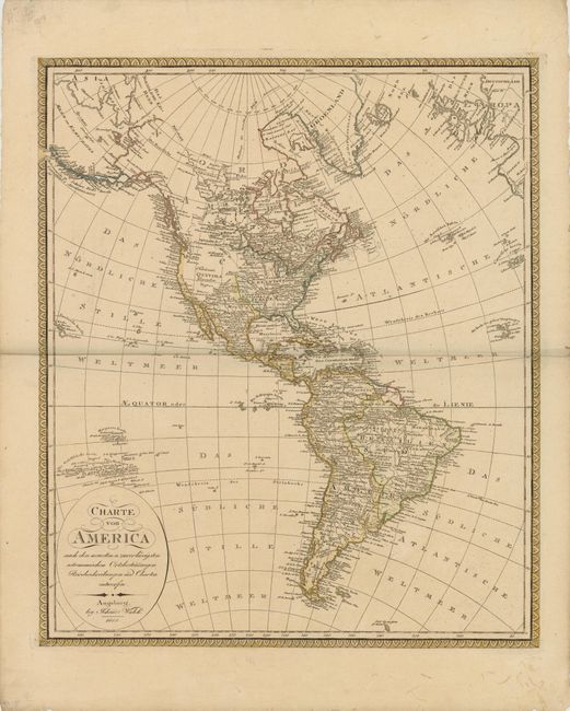
Large attractive map of the Americas, extending to include the eastern tip of Russia and part of western Europe. There is good detail throughout except in the northwestern regions of North America, which are left largely blank with the notation Unbekante Gegenden (unknown areas). The United States is depicted with its new acquisition of Louisiana Territory but still confined east of the Rocky Mountains, and several settlements in Texas are named. The Colombia River is shown with a dotted line connecting it with another river to the north, leaving open the possibility to the long sought navigable passage across North America. The Hawaiian Islands are shown as the Sandwichs Inseln with phonetic spelling for the individual island names. Between Hawaii and California there is an erroneous group of islands with Spanish names. These islands were introduced on maps in the mid-18th century and were not corrected until the early 19th century. The South American continent is very well mapped and filled with detail, although the mythical Parime See is still shown in Guyana. The map is adorned with a simple oval title cartouche and a decorative border.
References:
Condition: B+
A nice impression with a couple of tiny spots and marginal soiling.