Subject: Japan & Korea
Period: 1636 (circa)
Publication:
Color: Hand Color
Size:
17.5 x 13.5 inches
44.5 x 34.3 cm
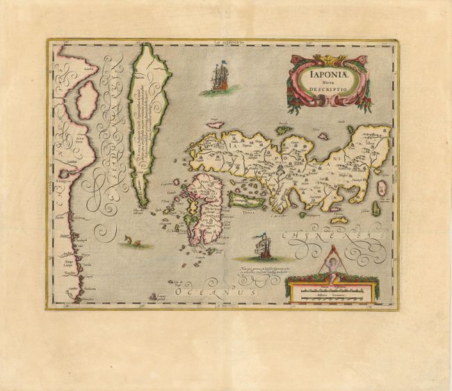
This map of Japan and Korea is presented on the Ortelius/Teixeira model, which had been the standard for mapping the region since Ortelius first published Teixiera's map in 1595. The map shows Korea as an island which tapers to a point and a cluster of islands labeled Ilhas dos Ladrones (islands of thieves). A label on the island notes that it is not known if Korea is an island or a peninsula. Jodocus Hondius engraved the map initially in 1606 with the title simply Iaponia and a Korean junk sailing below Japan. Jansson made his mark on the map, which he re-engraved for his editions of the Mercator Atlas 1636-1649, by changing the title and the ornamental features, including two decorative cartouches, two European ships, and a sea monster. Latin text on verso.
References: Walter #23; OAG #18.
Condition: A
Lovely old color and wide margins with a printer's crease alongside centerfold.