Subject: Holy Land
Period: 1638 (published)
Publication: Newer Atlas…
Color: Hand Color
Size:
19.5 x 14.5 inches
49.5 x 36.8 cm
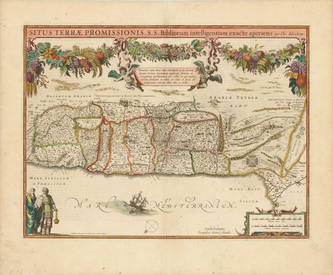
Superb map of the Holy Land based on the cartography of Christian van Adrichom. With north oriented to the bottom left, the map covers from the Nile delta to Sidon and is divided into the twelve tribes. It is finely engraved with minute detail and depicts numerous biblical scenes including the Exodus, the wandering of the Children of Israel, and several battle scenes. A floral and fruit garland is draped across the top, symbolizing the land of plenty. It is further decorated with two putti holding up a banner containing a Latin verse, figures of Moses with the Ten Commandments and Aaron dressed in the priestly vestments, Jonah and the whale, and a strapwork distance scale. Engraved by Everadus Sim. Hamersveldt and Salomon Rogeri. German text on verso.
References: Laor #23B.
Condition: A
Wide original margins with a faint printer's crease adjacent to centerfold and a professionally repaired centerfold separation at bottom.