Subject: World Miscellany
Period: 1877 (published)
Publication: National Atlas
Color: Hand Color
Size:
15.5 x 12 inches
39.4 x 30.5 cm
This is a lot of 8 maps on 4 sheets from O.W. Gray's The National Atlas Containing Elaborate Topographical Maps of the United States. Each map delineates political boundaries and shows good detail of roads, railroads and watersheds.
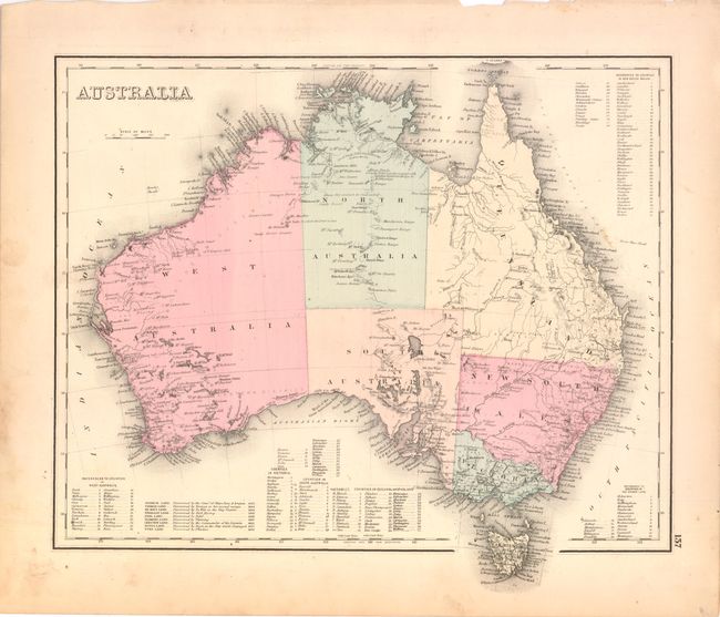
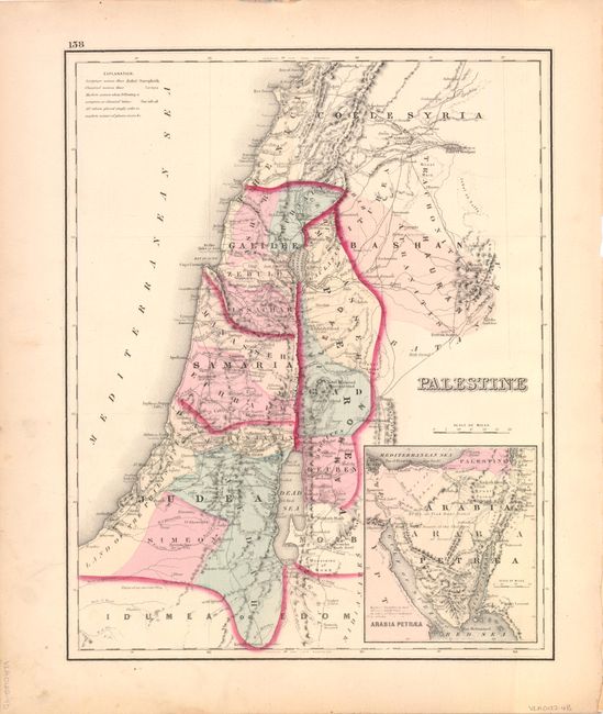
A. Australia [on verso] with Palestine. The map of Australia shows the extent of settlement and exploration into the interior. There are a few railroads in New South Wales and in the Brisbane vicinity. Tasmania is still labeled Van Dieman Land. Tables list the counties for each territory and another list notes important discoveries. The map of Palestine includes an inset of the Arabian Peninsula.
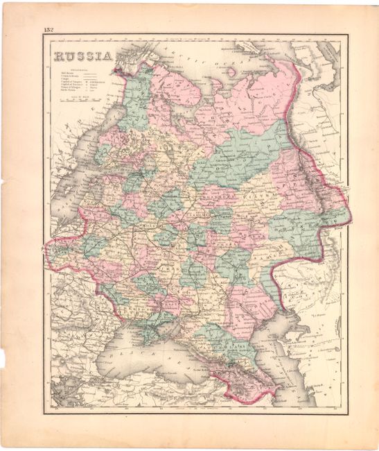
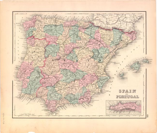
B. Russia [on verso] Spain and Portugal. This map of European Russia extends to the Ural Mountains and extends south to the Caspian and Black Seas.
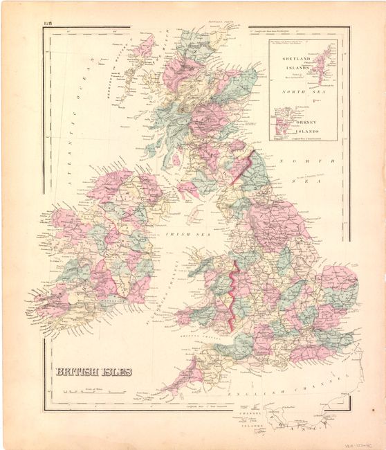
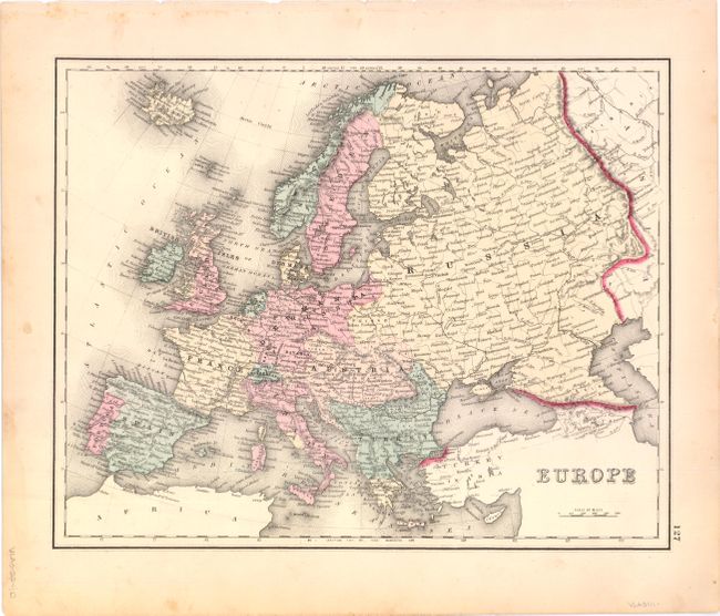
C. British Isles [on verso] Europe. This map covers all of the United Kingdom with an inset of the Shetland and Orkney Islands at upper right.
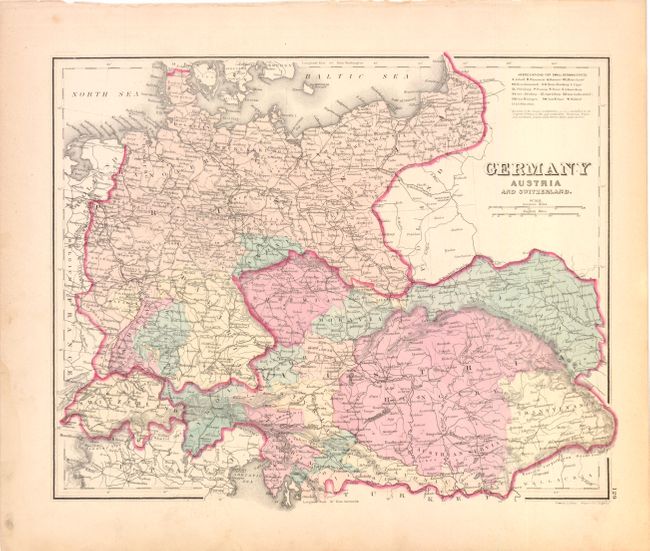
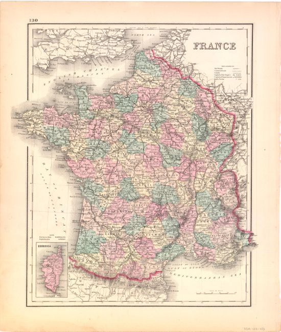
D. Germany Austria and Switzerland [on verso] France. At this time Austria included Bohemia, Tyrol, Galicia, Hungary, Transylvania, Austrian Servia, Styria, Sclavonia, Croatia, Istria and Illyria.
References:
Condition: B+
There is some minor soil and foxing primarily in the blank margins with some very minor tattering and edge tears, well away from the images.