Subject: Black Sea
Period: 1856 (dated)
Publication: Senate Doc. No. 1, 34th Cong, Special Session
Color: Hand Color
Size:
45.5 x 29.8 inches
115.6 x 75.7 cm
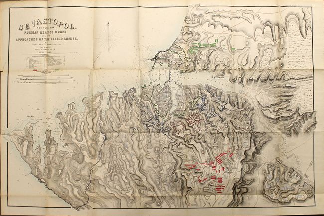
This scarce map shows the positions of the Russian troops (in green) and English and French troops (in red and blue) around the city of Sevastopol, in present-day Ukraine, during the Crimean War. Sevastopol was a pivotal battleground, as it was a critical port in the Black Sea. The map detail includes the street layout of Sevastopol, numerous forts, artillery placements, and very detailed topography. Drawn by Lieutenant George R. Wilkinson and Captain T. Spratt for the British Hydrographic Office: this is the U.S. edition.
References:
Condition: B+
Original color. Folding as issued. There is a binding tear that just touches the neatline at left and a few edge tears repaired on verso with archival materials, all of which are confined to the blank margins. There are a few faint spots.